I need to improve the data for Los Gatos Creek Trail (LGCT) on this trail flooding status page for Santa Clara County, California, so I plan to ride LGCT in the middle of the rainstorm expected on Friday. Who wants to join me for this ride?
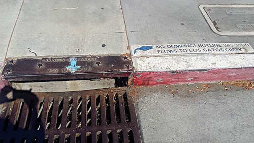
Leigh Avenue is the street immediately west of Blackford Elementary School, where many trail users cut through the parking lot to access Willow Street. Here’s a storm drain on Leigh immediately over the Los Gatos Creek Trail.

This drain collects significant runoff from the street, along with some from the school parking lot. Frequent trail users likely already know that this drain dumps onto the trail below.

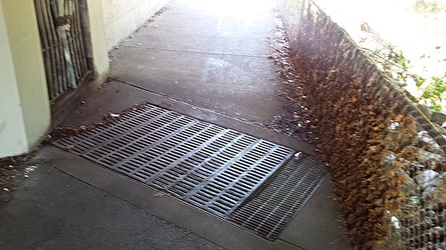
Theoretically, the water should flow from that outlet against the wall directly down into that grate below. The leaves plastered into the chainlink fence hint at the reality — trail users must push through a waist-deep torrent.
This trail is well above the creek, even at undercrossings. Besides Leigh Avenue, the only other problem spot I’m aware of is a low spot near Vasona Park. I’ll decide Friday morning if I want to backtrack into Los Gatos to check flooding at that location.
I’d like to shoot photos and video of the torrent as it occurs for advocacy purpose. A human subject in these images would be great. Ping me if you think you can join me somewhere along the way. I plan to be in Campbell about 8 A.M. on Friday for this ride, and will probably get to Leigh around 8:30. You can expect you and your bike to get soaked during this ride, so bring a towel.
Thank you, Richard!!
I started to regularly commute this way last year. I found only one day last winter, January 22, that it was too deep to cross. Most of the time during storms, there will be a few inches of water. It’s easy enough to cross carefully with big tires and full fenders. Luckily if it floods, it’s fairly quick to cross Leigh on the street.
I don’t think there are any other problem areas, except for that bumpy bridge under Campbell ave.
I agree the bypasses are trivial for Los Gatos Creek Trail; I only put some emphasis on the trail because it happened to be easy for me to look at yesterday. Too bad the rain didn’t materialize. Agree also that most of the trail isn’t a problem.
Thank you for that Jan 22 datapoint — that’s exactly the kind of invaluable information I’m looking for. It rained half an inch that day, which is about a week’s worth of precipitation for a normal January. I don’t anticipate flooding on LGCT this weekend but if you do run across flooding later this season I’d love if you could tell me data and time if you think about it. Thank you again!
Of course! I follow you on instagram(@brvln). I can tag/notify/whatever you when I find some interesting water flows on the trail.