Silicon Valley Bicycle Coalition Executive Director Corinne Winter announced her resignation Wednesday afternoon.

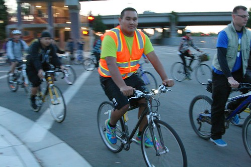
Last year, an attorney began contacting San Jose Bike Party organizers, volunteers and riders while preparing a lawsuit against a shopping center where a Bike Party participant injured herself during one of the monthly night rides. This conversation prompted a few in the cohort to talk about ways to protect themselves from liability.
Real time trail flooding info for selected trails in the cities of San Jose, Santa Clara, Los Gatos, and Milpitas in Santa Clara County, California.
Update: Thank you so much and please keep your flood reports coming. I have the Guadalupe River Trail pretty much nailed down. I’m currently seeking time and dates for flooding on Coyote Creek under 101 (and other locations it might flood).
The trail status page captures automated real-time river flow and precipitation data to predict trail flooding at selected locations throughout Santa Clara County. Updates occur hourly from 5 P.M. to 10 P.M, and again from 3 P.M. to 8 P.M. I have to limit my number of daily checks because the weather API I use costs me money. If you would like to support this effort, please browse my Amazon affiliate online store, which sorts various categories of vaguely bike-related merchandise into the previous week’s top selling items at Amazon.
During the summer, this gauge normally reads around 5 to 5.5 feet deep. For anything over seven feet, the trail under the Green Island Bridge and Highway 101 is underwater. Because of urban runoff from non-porous paved surfaces, even a few hundredths of an inch of rain is enough to flood the trail under Highway 101. For northbound detours, go east on Airport Parkway to North 1st Street, where you can ride with fast and heavy traffic in reasonably wide and clear bike lanes. The other detour is to continue north on Airport Boulevard past long-term parking, toward the taxi waiting area, and continue through the road barrier onto Ewert Road (yes, bikes are allowed here, I asked). Ewert takes you to where Central Expressway ends at De La Cruz / Trimble. From this intersection you can either go north onto Trimble (but the Hwy 101 overcrossing is not for the faint of heart), or continue west on Central until you hit the San Tomas Aquino Trail.
If the trail is flooded until 101, you can generally count flooding under Trimble Road and Montague Expressway also.
The trail under I-880 floods when the gauge is over about 10.5 feet. Northbound detour: go east on Hedding to 1st Street, where you have 1.6 miles of “share the road” on narrow lanes until you reach the bike lanes at Brokaw Street. Your other option is Hedding to 10th, make a left where Old Bayshore crosses under I-880, then continue north on on the bike lanes on Zanker Road.
Downtown undercrossings are fairly easy to bypass on surrounding surface streets, so I leave that as an exercise for the rider.
I ride the Guadalupe River Trail daily, so the trail’s flooding predictions are probably as dialed in as I can make it. Because the trail prediction is automated, I can’t account for debris (such as the impassable debris pile on the trail under Montague Expressway January / February 2017).
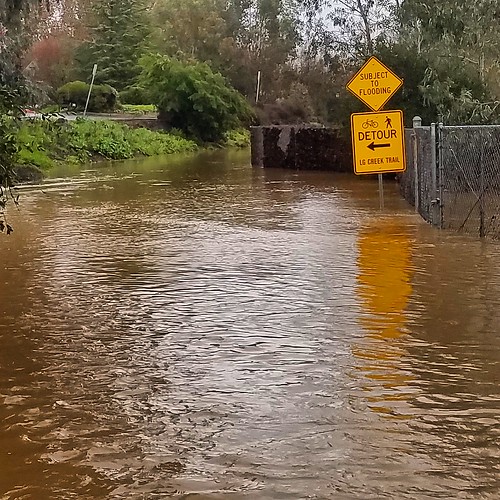
Some lower parts of the Creek Trail through Los Gatos can be subject to flooding. I post those as “Vasona Park” on the trail status page. The photo at the top of this page shows the Los Gatos Creek Trail by Charter Oaks between Lark Ave and Netflix HQ.
Does anyone use that culvert where Stevens Creek flows under I-280 on the western edge of Cupertino?
California Nevada River Forecast Center
USGS River Flow Current Conditions for California.
Santa Clara Valley Water System Real Time Data (includes stream flows at numerous locations throughout Santa Clara County).
H/T to Roger Weeks who turned me on to this information several years ago and put the bug in my ear about this predictive trail flooding info page.
When the city of San Jose DOT presented information about proposed cycling facilities to East Side residents last summer, staff learned that East Side residents want more white stripes of gentrification for their neighborhoods. To that end, the city received a grant to build on-street bikeways in this area and seek community input on how to spend this money.