![]()
Those spending their time conquering the Seven Summits or riding the Divide might ask “What is Aleppo?”
Posted In Uncategorized
![]()
Those spending their time conquering the Seven Summits or riding the Divide might ask “What is Aleppo?”
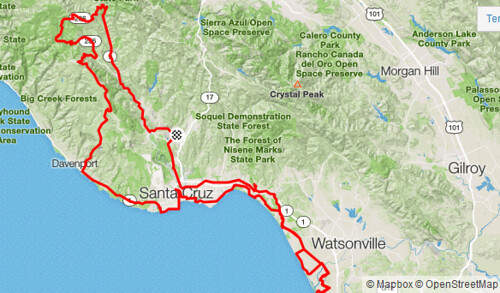
I’ve touched thirteen of the sixteen California State Parks and Beaches in Santa Cruz County by bike, but never in a single day. What about hitting all of them in a single ride?
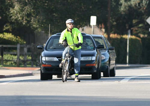
I’m reading Aaron’s Five Laws of Bicycling Survival, which is mostly a New Yorker’s slightly flippant description of what Bike Arlington (Virginia) calls “Predictable, Alert, and Lawful” or PAL.
The city of San Jose Parks, Recreation and Neighborhood Services department is updating their “Greenprint” — their long-term strategic plan that guides the future expansion of San José’s parks, recreation facilities and community services — and invites residents and visitors for your feedback via an interactive map survey.

To give your input, click through to the Greenpoint Interactive Map Survey, and drop pins on the map. You can write about what parks, trails and community centers you use and like, and also identify problem spots.
H/T once again to Betsy.

The Santa Clara Valley Transportation Authority (VTA) announced two public meetings as the agency develops a strategic plan for the I-280 corridor across Santa Clara County in the San Francisco Bay Area.
The purpose of the study is to develop a strategic plan for the 22-mile portion of I-280 corridor located in Santa Clara County. The study limits extend from the US 101/I-280/ I-680 interchange in San Jose to the San Mateo County line near Palo Alto. The study will focus on highway “improvements” (e.g. interchange spacing, congestion relief, express lanes, etc.); bicycle and pedestrian improvements (e.g. access, cross connectivity, safety; transit service improvements (e.g. VTA light rail and bus services; Local roadway improvements (e.g. cross connectivity, etc.); and noise abatement (e.g. sound walls).

The Scorcher Menace strikes again! Ted points to this story of a school bus driver forced to swerve off of the road because, according to the initial headline, some kid was riding home from school on his bicycle in Columbia, Missouri.